At the Archives #1 A minimalist approach
At the Archives #1
A minimalist approach
In the first of two blog articles, Collections Care Conservator Rachel Wales reveals the preparatory conservation work behind-the-scenes at Gloucestershire Archives to prepare historic tithe maps for digitisation by the Know Your Place project:
“At Gloucestershire Archives, we gather, keep and share the documentary history of two counties – Gloucestershire and South Gloucestershire.
To this end, Gloucestershire Archives is involved with a fantastic Heritage Lottery funded project known as “Know Your Place – West of England”. This project is headed by the South Gloucestershire Council and involves a huge number of heritage organizations. When completed, the project will allow unprecedented online access to historic maps of South Gloucestershire, Gloucestershire, Wiltshire, Somerset, North Somerset, and Bath & Northeast Somerset. Our main challenge at Gloucestershire Archives has been to digitize our collection of 200 19th-century tithe maps.
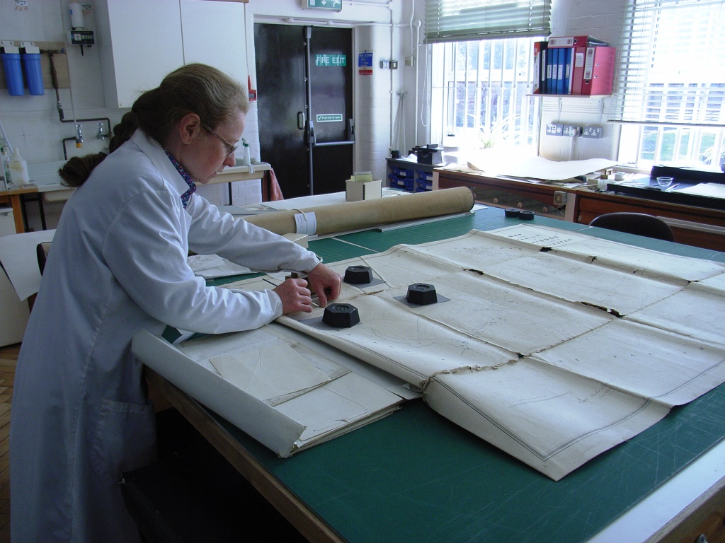
Most of our tithe maps are drawn in a variety of media on heavy wove paper which is then adhered to a lining of unbleached linen. Most have an apportionment – a document written on sheets of parchment which provides information about land ownership – sewn onto one of the short ends of the map. The maps were then folded around the bulk of the apportionment, creating a very characteristic pattern of damage, particularly at the intersections of the vertical and horizontal folds. Many were also grimy with dust and sooty deposits.
In 2012, Conservation Manager Ann Attwood and I began a survey of all the maps to be imaged. By July 2014 when the survey was complete, we knew that there were 116 maps needing conservation treatment.
Conservation Manager Ann Attwood works on a tithe map
So, we had a daunting challenge facing us – 116 tithe maps, two part-time conservators with busy schedules, and roughly one year before digitizing was scheduled to begin. The Heritage Lottery Fund grant did allow us to work some extra hours, without which we would not have been able to complete the work in time.
We decided that we would adopt a minimalist intervention approach – doing only what was absolutely necessary to obtain a good digital image, and to ensure that the maps could be handled safely during the imaging process. This meant that we would repair any significant tears in the paper and linen, we would surface clean to remove any grime that obscured map features and that might become permanently ingrained in the map when it was being handled, and we would repair areas where folded and crumpled paper obscured features on the maps.
The equipment and setup of the digitization process played a large part in persuading us that this minimalist intervention approach would work. The layout of the ICAM Atlas equipment meant that the maps were laid out flat onto a large powder-coated steel bed, with the camera positioned far overhead. Small maps were captured in one shot. With larger maps, the steel bed rolled back and forth to permit multiple shots that were then stitched together digitally. Weights and magnets were used to gently pull the map flat if needed. With careful handling and positioning on the steel bed, even fragile maps could be laid out and imaged.
This minimalist intervention approach is so quick, in contrast to Gloucestershire Archives approach in years past which saw damaged maps undergoing full relining on the wall board.
But there are other advantages to this approach. There was a reduced risk to water-soluble material. It meant the retention of all original material such as the linen backings, and there was no need to remove any attached apportionments. This preservation of evidential value was especially important to the Archives. In most cases, we were able to retain the original storage format (i.e. the maps could be folded up again and put in boxes), which suited the storage space we have available. Carrying out small, local repairs meant that we were able to work on maps larger than the largest table available to us, and the maps which were larger than our wallboard. We did this by partially unfolding the big maps and working on just one small manageable section at a time. Most of the work could be done by a single conservator working alone, with occasional help from colleagues to assist with the moving and refolding of big maps.
And, of course, this minimalist approach does not preclude more in-depth treatments in the future.”
In the second blog article, we explore what happened next to these historic tithe maps conserved for the Know Your Place project…